Showing posts with label 4WD. Show all posts

Monday, 24 August 2026

From the Kalahari to the Fish River Canyon – The Long Way South


We leave Outpost Safari Lodge early
We have a long drive to Canyon Lodge
Namibia 2026


Today we leave Outpost Safari Lodge near Unions End and embark on a very long drive all the way to Canyon Lodge, near the eastern side of the Fish River Canyon and the Hobas entrance gate.

For some time, I have wanted to explore more of the small back roads in this remote part of Namibia. On a previous journey, we had a fantastic drive along the little D1033, the “Olifants River Road” (link D1033 trip).

This time, we decide to take one of the most easterly routes possible through this part of Namibia. We follow the D1022, then the D1119 and D511, before eventually turning southeast onto the somewhat larger C17 towards the small town of Koes and onwards to Keetmanshoop.

It turns out to be a perfect plan.


Start of D1022, runs lengthwise
 between the dunes most of time
Namibia 2026


Almost nobody on the road


D1022, we meet only three other vehicles!
Freshly graded track
Namibia 2026


During the first three hours, we encounter just three other vehicles!

We initially head south on the D1022, which turns out to have been freshly graded and is in absolutely perfect condition.

And here I was, expecting loose sand and a potentially challenging 4WD drive!

Instead, the road runs lengthwise between the dunes, and only occasionally do we cross from one dune ridge to another. This creates long, straight stretches interrupted by short but beautiful climbs over the dune crests.


Road D1119, distance between
the dune ridges shorter, red sand.
Namibia 2026


When we reach the D1119, we start heading more towards the west. The distance between the dune ridges becomes shorter, and the character of the drive changes.

It gradually develops into something resembling a roller coaster ride over the now quite high dunes – still, however, on beautifully graded gravel.

The dunes have also changed character. They are becoming increasingly red, with the characteristic colours of the Kalahari becoming more pronounced.


Blogger break D1119
Namibia 2026


But this year there is something else.

Flowers.

And more and more of them.

The further south we travel, the more flowers we see scattered across the desert. In places, the normally dry landscape is surprisingly colourful.

The desert is still blooming.

How incredibly lucky we are to be here at exactly the right time.


Giants and quiver trees


 Near Quiver Tree Forest
Namibia 2026


After passing the small town of Koes, we eventually approach Keetmanshoop.

Along the way, we pass two of southern Namibia's most unusual natural attractions: Giants' Playground and the Quiver Tree Forest.

Giants' Playground is a remarkable landscape of enormous dolerite boulders, piled and balanced in seemingly impossible formations. The rocks look almost as if some enormous hand has stacked them on top of each other – hence the name. The formations are entirely natural, created through geological processes and prolonged weathering and erosion.

Just a few kilometres away lies the famous Quiver Tree Forest, a natural concentration of Aloidendron dichotomum, commonly known as quiver trees or kokerboom. The trees are actually giant succulents rather than true trees, and some of the specimens are several centuries old. The San traditionally hollowed out the branches to make quivers for their arrows, which explains the English name.

We visited both places back in 2009, when our children were just nine and ten years old.

We still have vivid memories of the strange rock formations and, in particular, the many spectacular quiver trees.

But we still have a very long drive ahead of us today, so we decide not to stop for a proper visit this time.

Instead, we simply admire the landscape from the road and pull over briefly on the roadside.

Sometimes it is enough just to see an old familiar landscape again.


Heading into the south

When we reach Keetmanshoop, we decide not to drive into the town itself, as we did some weeks earlier with my brother and sister-in-law on the way to Klein-Aus Vista (link).

Instead, we continue directly towards the eastern side of the Fish River Canyon.


Turning south onto the C12
Namibia 2026


In far distance,
we begin to see mountain ranges
Namibia 2026


After turning south onto the C12, the landscape changes once again.

The open desert seems to stretch endlessly in every direction.

There are even more flowers now, and in the far distance we begin to see mountain ranges.

At first, they are barely visible on the horizon.

But as we continue south, they become more distinct, rising gradually above the enormous plains.


Flowers and mountains more distinct
Gondwana Canyon Park
Namibia 2026


We cross below Naute Dam
Namibia 2026


The landscape is becoming increasingly dramatic.

We eventually turn onto the C37 for the final stretch towards Gondwana Canyon Park.


Final stretch towards Gondwana Canyon Park
Namibia 2026


The views become more and more spectacular.

Gondwana Canyon Park is an enormous private conservation area covering approximately 1,160 km², or 116,000 hectares – about 27% of the area of Denmark – surrounding the Fish River Canyon. The area has been developed around the idea of combining conservation, landscape restoration and tourism, and wildlife such as plains zebra, wildebeest, red hartebeest and giraffe has been reintroduced.

It is a fitting landscape for the next chapter of our journey.


Finally – Canyon Lodge


Canyon Lodge front
Namibia 2026


And finally, we arrive at our destination.

Canyon Lodge.

The lodge lies among enormous granite boulders within Gondwana Canyon Park, approximately 20 kilometres east of the Fish River Canyon. The stone chalets are scattered between the rocks, and the setting is spectacularly remote.

We are going to stay here for three nights.

We have visited the Fish River Canyon twice before – in 2022 (link) and a few weeks ago with my brother and sister-in-law (link) – but both times from the western side.

This time, we are going to explore it from the eastern side, around Hobas.

After the long drive from the Kalahari, it feels good to finally arrive.

The car has done another very long day, but the journey itself has been an experience.

And tomorrow, we will finally get to see what the Fish River Canyon looks like from this side.

We are very much looking forward to the next few days.

Thursday, 13 August 2026

NamibRand – Desert Days, Oryx and a Windblown Sundowner

 
NamibRand Family Hideout
Milkey Way
Namibia 2026

Back to NamibRand

We arrive at “our” lovely farm, The NamibRand Family Hideout, remotely situated in south-western Namibia within the stunning NamibRand Nature Reserve, one of Southern Africa’s largest private nature reserves. We are looking forward to settling in and enjoying the spectacular views across the vast plains towards the ancient blue mountain ranges.

After unpacking and settling into the house (link), we decide to take a drive along the approximately 5-kilometre self-drive 4WD track. It is a beautiful and, from a driving perspective, not particularly difficult route through the surrounding landscape — a perfect introduction to the terrain before our much longer four-hour nature drive, which we have booked in advance.


Oryx suddenly appear,
standing with their calves
Namibia 2026


We have just passed the first sandy rise when two large oryx suddenly appear, standing with their calves in the shade of a tree only about 30 metres from us. We see oryx everywhere in this part of the reserve. They are remarkably well adapted to life in this extraordinarily dry environment and can survive with little or no access to drinking water, obtaining much of their water from the plants they eat and conserving water with highly efficient physiological adaptations. Their ability to cope with dehydration and heat is one of the reasons they can thrive in landscapes where surface water is virtually absent.

It is wonderful to be able to drive on our own through this landscape, although the restrictions on where we can go are entirely understandable. In a fragile desert ecosystem like this, even apparently insignificant vehicle tracks can leave a lasting footprint, and conservation naturally has to come first.


Sunset on the Dunes


Sunset on highest sand dune
Blogger, wife and family
Namibia 2026


As sunset approaches, we decide to experience it from the highest sand dune we spotted during our earlier drive. We pack our chairs and the essential G&Ts and set off.

Climbing a steep sand dune is hard work — two steps forward and one step back! The sunset wind is already blowing quite strongly, whipping sand across the ridge, while the colours of the landscape gradually become warmer and more intensely reddish. At the same time, the lowering sun throws increasingly long shadows across the dunes and plains.

We are now close to Venus Campsite, where we stayed with good friends two years ago (link). It is one of those places where previous journeys suddenly become part of the present one.


Sun disappears behind the mountain range
Namibia 2026


There are plenty of photographs taken from the top of the dune, but eventually the sun disappears behind the mountain range — the same range where we once slept on camp beds out in the desert, while spotted hyenas visited our camp during the night on Tok Tokkie Trails (link).


Heading back for the fire
Namibia 2026


It is striking how rapidly the temperature drops in the desert the moment the sun disappears. Within minutes, we are very happy to head back to the house, the fire and our grilled lamb chops — bought during our rather unsuccessful shopping expedition to Lüderitz (link).

We are, however, suffering in the most luxurious possible way. Somehow, we even managed to acquire some fresh salad from the greenhouse near the reception where we checked in.


Evening with wife, brother and sister-in-law
NamibRand Family Hideout
Namibia 2026


It is a magical evening in the company of my brother and sister-in-law. Once complete darkness has descended, but before the full moon rises, we sit outside and admire the spectacular Milky Way stretching across the sky above us (see first picture). NamibRand is particularly renowned for its exceptionally dark skies, making the desert at night almost as impressive as it is by day.

We spend a wonderfully peaceful evening in the spacious house before getting ready for our four-hour nature drive the following morning, departing at 7:30.


A Very Cold Morning


Clouds and cold morning
NamibRand Family Hideout
Namibia 2026


And then we discover something quite unusual for early August: clouds!

Winter in this part of Namibia is normally characterised by dry, clear skies, warm sunshine during the day and very cold nights. Rainfall is highly erratic, and the period from roughly May through August is generally the dry season. Temperatures can fall dramatically after sunset, with frost and even sub-zero temperatures possible in the NamibRand area.

This morning is therefore a bit of an exception. It is overcast, cold and surprisingly windy.

We quickly realise, after only a few hundred metres in the open vehicle, that we have become thoroughly acclimatised to the warmth of the preceding days — and have dressed far too lightly. We are absolutely freezing as we head out into the reserve, exposed to the wind chill created by the moving vehicle.

A blanket, as provided on many other nature drives, would have been very welcome!


Sunrise cold morning
NamibRand 4 hours nature drive
Namibia 2026


Fortunately, we almost forget the cold when the sun begins to rise over the desert. The first rays illuminate a distant line of dunes, creating an extraordinary landscape of muted colours. We stop on a high dune, where we have a magnificent panorama over the surrounding wilderness.

The colours are almost surreal to our eyes: every conceivable shade of khaki, grey, sand and blue-green, changing subtly as the sun climbs higher.


Colours are almost surreal, NamibRand
Namibia 2026


Then comes the adventurous part.

Our Land Cruiser heads diagonally down a very steep sandy slope. We instinctively use arms and legs to brace ourselves, trying to prevent all four passengers from ending up on the same side of the vehicle. Fortunately, our driver clearly has complete confidence in what the Land Cruiser can do.

We are less convinced.

For a moment, it feels as though the whole vehicle might simply tip over sideways.
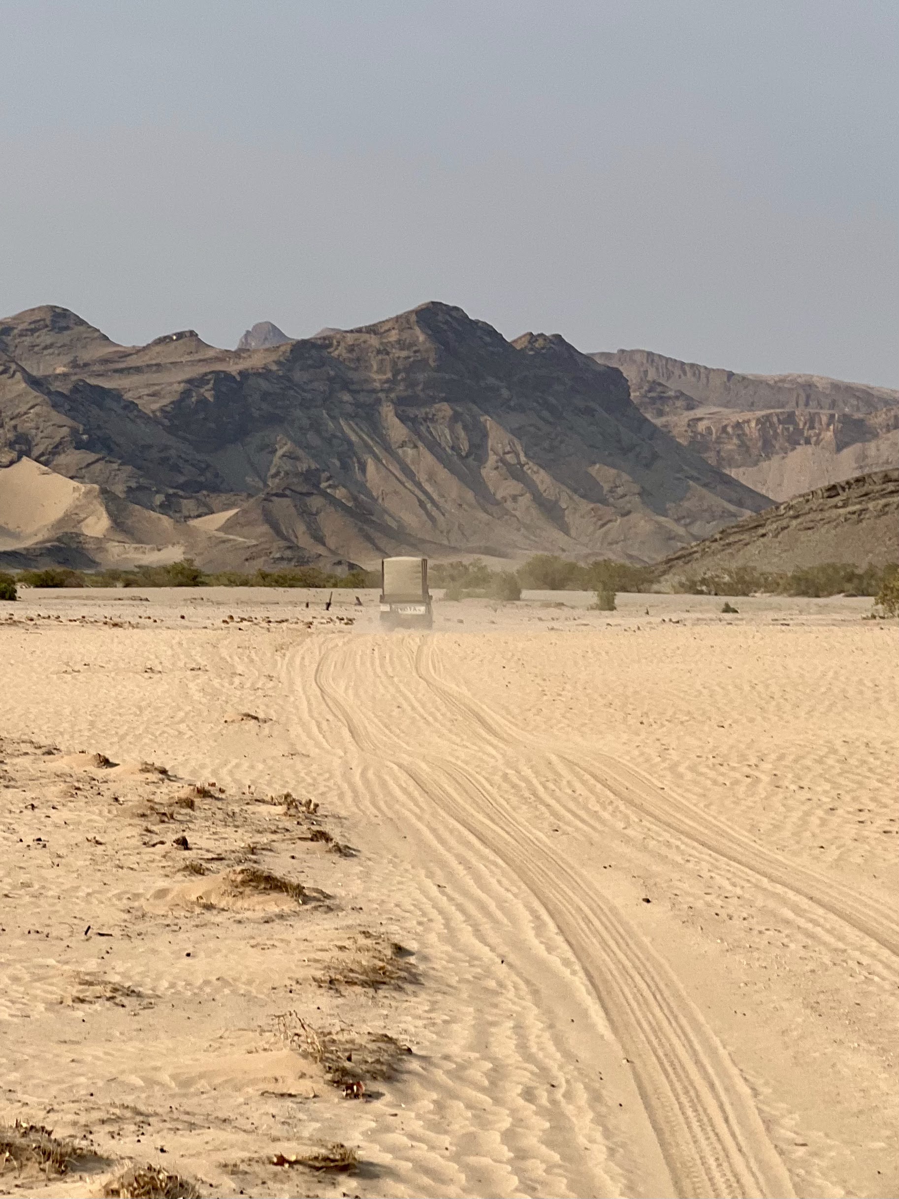
It doesn't.


Just before very steep sandy slope
Not possible to see on picture
Namibia 2026


Into the Unknown

From here, we continue towards the most remote south-western parts of the reserve, on a route that takes us considerably farther into NamibRand than we have ever been before. I keep trying to follow our route on my otherwise completely reliable Tracks4Africa map — but the tracks we are driving simply aren't there.


Into the unknown
NamibRand 4 hours nature drive
Namibia 2026


Desert blooming
NamibRand 4 hours nature drive
Namibia 2026


That is quite something!

The afternoon is spent relaxing — and, not least, warming up — after our exceptionally cold morning and long drive.

Late in the afternoon, another adventure awaits.


The Deception Hill Climb

We are going to climb the nearby rocky hill known as Deception Hill on what is called the “Koppie Climb”. The excursion includes transport and a guide and promises a magnificent sundowner viewpoint.

Before booking it, I had tried to establish exactly which mountain was involved and whether the climb would be suitable for our family group of four. I remember all too clearly the extremely demanding climb I once undertook alone, accompanied by two guides, to the summit of the area's highest mountain, Mount Loosberg. That expedition was wild — and at times came close to being downright irresponsible! You can read about that adventure here (link).

This little expedition, fortunately, turns out to be considerably less demanding, although there are still a few steeper´ish sections.


Leaving Land Cruiser at nearby hill
Deception Hill Climb
Namibia 2026


We drive to the nearby hill and leave the Land Cruiser at its foot. From there we follow an old livestock fence upwards over the rocky terrain, enjoying the increasingly beautiful evening light across the desert.

We are also very careful about where we put our feet. The warm rocks and sandy path are exactly the sort of places where snakes and scorpions may enjoy an afternoon sunbath.


On the way to first top
Deception Hill Climb
Namibia 2026


Eventually, slightly out of breath, we reach the top of the rocky hill.

And now we understand why it is called Deception Hill.

Because we are not actually there yet.


Not there yet!
Deception Hill Climb
Namibia 2026


A Sundowner Above the Namib

From the top of the first hill we discover that the route continues down into a saddle — and then upwards again onto a second, higher hill that had been completely hidden from view.

Not everyone in the group is equally enthusiastic about this revelation ;-)


Looking back from sand dune to rock top
Deception Hill Climb
Namibia 2026


And the second summit is different again. Instead of the rocky terrain we have just climbed, it is a steep sand dune.

But naturally, we take on the challenge.

And we are rewarded spectacularly.

As the sun begins to disappear, the desert is transformed into an extraordinary palette of reds, oranges and deep shadows. The wind is blowing hard across the dune, sending fine red sand swirling around our legs and faces.

Getting a G&T poured and safely delivered to the top of the dune is itself becoming something of a luxury expedition in the blowing sand.

But naturally, we manage.

It is a long-standing sundowner tradition in the Namibian desert — and what could be more appropriate than celebrating it with the local Desolate Gin No. 7?

We stand on top of the dune, glasses in hand, watching the last light disappear across one of the most spectacular landscapes on Earth.


On the top!!
Deception Hill Climb
Namibia 2026


Another extraordinary day in the Namib.

Tomorrow, the next stage of our journey awaits — and with it, new adventures.

We feel very, very privileged.

Sunday, 27 October 2024

Extreme 4WD Adventure: Rooidrom, Joubert's Pass, and Beyond!


On the way to the top of Rooidrum Pass, Namibia, 2024.

"Below, I recount the thrilling story of what turned out to be our wildest 4WD experience in Namibia to date. We were pushed to the limit, and it became a very long day, requiring a major detour through desolate desert landscapes, navigating some of Namibia’s toughest passes, including Rooidrum and Joubert's Pass, and passing the famous landmarks Rooidrum and Bloudrum on the round trip through Orupembe and back to Etambura Camp!"

A full day circular 4WD tour through some of Namibia’s toughest passes!


On the top of Riooidrum Passs in Kaokoland,  
one of the wildest and least populated areas in Namibia, 2024.

We’re in northwest Kaokoland (now known as the Kunene Region since 1990), one of the wildest and least populated areas in the country, with a population density of just one person every 2 km². Kaokoland stretches from the Hoanib River in the south to the Kunene River, which also marks the border between Namibia and Angola. The landscape is largely mountainous, dry, and rocky.

One of Kaokoland’s famous and - and infamous - features is its incredibly challenging and legendary 4WD tracks that wind through mountains, rocks, and desert sand. The most famous and notorious of these is Van Zyl’s Pass, beginning at Otjihende, where you descend through a difficult passage to the Marienfluss Valley. 

Nearly as famous are Rooidrom and Joubert's Passes, located right next to Etaambura Camp, where we’re staying in a spectacular setting that feels like a cross between Tranquility Base and the Garden of Eden (link to travel report). 

The emptation is just too strong! We’re “right next door” and can explore two of Namibia’s three most famous (and notorious) passes. On top of that, we’re armed with two solid Toyota Land Cruisers equipped with 4 spare tires, repair kits, winches, a satellite phone, and various tools.

Before setting out, we make sure to bring plenty of water. We then head down the steep path from Etaambura Camp, turning north, and pass the turnoff to Marble Mine and House on the Hill. Spirits are high as we follow two tracks on the hard, rocky ground, keeping in constant contact between vehicles via walkie-talkies.


The challenges start suddenly!

The challenges start suddenly as we reach Rooidrum Pass! This proves to be the wildest 4WD experience in Africa so far! 

I stop the Land Cruiser in front of the steep ascent, which looks more like a cliff face with small ledges at different levels and high rock walls on both sides. The cliff is covered in stones of various sizes, with deep cracks and holes throughout. Is this really the way up?


I get out and hike up to the top of the pass.
This is indeed the trail  - wild!!!

I get out and hike up to the top of the pass. This is indeed the trail  - wild! My heart rate and blood pressure rise as I decide to take on the climb! I set the Land Cruiser in low gear, with four-wheel drive and traction control engaged. Impressively, it powers through the steep rock obstacles as I do my best to steer around the largest holes and cracks.

I notice that my tire pressure is too low for this rocky stretch, but it’s too late to change once you’re on the incline. It doesn’t help that the handbrake on our Bushlore Land Cruiser is too weak! If we stall, the plan is for my fearless wife to jump out and place four large rocks behind the wheels. We actually drove this stretch alone with our children in 2012 in a Land Rover Defender, but the pass feels far more challenging now as much of the gravel has washed away, exposing deep cracks.

We make it to the top, with my pulse and blood pressure even higher, but fortunately, the tires stay intact without coming off the rims or getting side cuts on the bulging sidewalls.


Walk down to guide friends!
Rooidrum Pass, Namibia, 2024

I then talk to our friends in Land Cruiser 2 (call sign “Rhino 2” on the walkie-talkies ;-) and they’re up for the challenge, despite this being their first trip to Africa! We might just have the most fearless friends in the world on this expedition! I walk in frot of their Land Cruiser, pointing out the best spots for wheel placement to avoid getting stuck in deep cracks and holes. They also reach the top without any issues, and we adjust tire pressure.

My wife and I adjust tyre pressure to 2.0
at top of Rooidrum Pass, Namibia, 2024.


We figure it can’t get any worse (famous last words, anyone?)

Surprised by the terrain’s difficulty, we consider whether to tackle the next nearby pass or turn back while we still can. We figure it can’t get any worse (famous last words, anyone?).


Sharp rocks on the trail,
high risk of side cuts!
Namibia, 2024

The drive up the next pass, Joubert's Pass, goes smoothly and seems easier than Rooidrum Pass. But the descent is a whole other story. Steep rock walls close in on both sides of the vehicle as we go down, with limited visibility of the obstacles ahead - large holes, loose rocks, boulders, and steep drop-offs. Going down proves much harder than going up! The risk is that the undercarriage might get stuck despite the high ground clearance, tires could puncture (especially side cuts), or the vehicle could tip if the balance shifts too much to one side. In some spots, there’s no choice - only a high path on one side and a lower one on the other. A toppled vehicle wedged between two high rock walls would be no joke to free, especially on a narrow, steep stretch (and at 2.5 tons with a weak handbrake!).

Down safely, wife takes break with one of
Kaokoland´s famous stonemen!
Namibia, 2024.

Fortunately, both vehicles make it down safely, though we’re exhausted and a bit shaken by the route’s difficulty. Now we face a dilemma: the only way back is the same route we just took! This wasx supposed to be a round trip! Our plan was to drive to the famous landmark - a red oil drum called “Rooidrum” - from there a bit into the renowned Marienfluss Valley, and then back the same way. But the thought of crossing the two mountain passes again seems a bit like tempting fate now that we’ve made it once, especially with our heart rates still up after that intense descent!


Our escape route!


Our approx. 150 / 8 hours
circular tour, Namibia, 2024.

There’s another possible route I’ve been considering on the map. According to Tracks4Africa, you can drive about 25 km west toward Skeleton Coast and the landmark Bloudrum - a blue oil drum - then follow a desert trail south for over 100 km to Orupembe, which we passed on our way to Etaambura Camp two days ago. There are no settlements along this way, just isolated stone and sand desert! This is a long, unknown detour for us, but with adrenaline still pumping from Joubert's Pass, the idea of avoiding the two passes is tempting. We decide to try this much longer route.


Rooidrom, Kaokoland,
Namibia, 2024.

We reach Rooidrum Pass without major issues (compared to what we’ve encountered so far). Here, we meet a safari group with two vehicles, one towing a trailer, carrying about ten tourists and all their gear, and heading toward the same route we just came from! Incredible. The experienced guide confirms that the route I found on the map is real, driveable, and less challenging than the two passes.


Blog author & wife at Bloudrum,
a landmark very few persons have ever seen!
Namibia, 2024.

Only "local life" we meet (with Himba shepherds)
during 8 hrs drive, between Rooidrum and Bloudrum
near only water pump, Namibia, 2024.

So, we continue westward to Bloudrum, a landmark that very few persons have ever seen, marking the entrance to one of Namibia’s most remote and inaccessible areas, Hartmann Valley. The only people we see over the next five hours are a group of Himba women with a herd of goats near the only well in the vast landscape. It’s surreal, as though we’ve traveled hundreds of years back in time, if not for our two massive Land Cruisers interrupting the scene.

As we headed west from Rooidrum, we crossed numerous dry stream beds and riverbeds. But after passing Bloudrum and turning south toward Orupembe, the landscape became less rocky and more like a sandy desert. 

Tje landscape just after Bloudrum,
Namibia, 2024.

Mountains East, separating us from
Etaambura Camp, Namibia, 2024.

A break after 6 hrs drive under one of the
only trees in the desert  (shade tree picnic spot)
on Tracks4Africa, Namibia, 2024.

To the east, we can see the mountains separating us from our camp at Etaambura. All around us, the colorful sands and mountains show every shade of brown, red, and khaki. We have to drive all the way around the mountain range and past Orupembe before heading back toward our valley. Thankfully, we filled up (at great expense) with diesel in Puros! We haven’t yet needed the 40 liters in our two jerry cans on the roof.


Home safe!

The last 15 km before Orupembe bring intense corrugation. If you have kidney stones, they’d shake right down to the urinary tract! It’s exhausting, and we’re definitely getting tired by now!

After Orupembe, we drive the final 30 km north to Etaambura Camp. The last 1,000 meters up the mountain trail suddenly feel very easy after Rooidrum and Joubert's Pass! 

The last 1,000 m up the mountain trail
to Etaambura Camp, now easy!
Namibia, 2024.

Geateful to be home safe with friends,
Enjoying sunset over Onjuva plains,
Etaambura, Namibia, 2024.

That evening, we unwind on the viewing platform atop the mountain at Etaambura Camp, grateful to be back safe and sound, with no punctures or mishaps. G&Ts are in order as we watch the sun set over the sacred Onjuva plains and mountains!

Tomorrow, we head on the long journey back to Opuwo (which, as it turns out, also held some driving challenges with powder sand and clay after passing Kaoko Otavi, but thats another story!).
 

A word of warning:

One of our four spare tyres!
Namibia, 2024.
Don’t enter this area unprepared. Help is a long way away if anything goes wrong. At minimum, bring a satellite phone and Tracks4Africa. Needless to say, the trip requires two solid 4WD vehicles, with full equipment.


Sunday, 20 October 2024

Via Hoanib Riverbed 4WD Trail to Puros


Hoanib Riverbed 4WD Trail, first part,
Namibia 2024.


While staying at Etendeka Main Camp, the manager at this lovely place recommended we take the “Hoanib Riverbed 4WD Trail” near Sesfontein on our way to Puros. We later confirmed this with a guide at Khowarib Lodge, who also endorsed the route. This guide mentioned that we could follow him to Hoanib the next day, as he was taking some tourists along the entire trail to “Amspoort Gorge.”

I felt a great deal of responsibility for our route and safety, so I was somewhat anxious before our departure the next day. Mainly because I know - from experience - that help can be very far away if you get stuck or if the Land Cruiser has technical problems in such a remote area. However, it was somewhat reassuring to know that we had two highly capable vehicles equipped with all the necessary expedition gear, Tracks4Africa for navigation, and a satellite phone for emergencies. 

Despite this, it can still be very stressful to break down along the way, something we have "enjoyed" several times before! Most recently on the Skeleton Coast, where we were stuck 120 km away from the nearest help with no satellite phone, after getting caught in quicksand in a salt pan (link scary report). Or when our car nearly caught fire in Central Kalahari Game Reserve with endless miles to the nearest help. Fortunately, we had a satellite phone that time (link report).

We ultimately decided that the route via the Hoanib Riverbed 4WD Trail to Puros looked very exciting, and we were all eager for the challenge! Early in the morning, we left Khowarib Lodge, following the guide and his guests. And ss soon as we left the D3707 after Sesfontein, we could see there were many different tracks in the sand. You constantly have to choose a track while trying to avoid the deeper ones with the loosest sand! 


We quickly spotted the first giraffes,
Hoanib Riverbed 4WD Trail,
Namibia, 2024.


In the beginning, the drive was relatively smooth, and we quickly spotted the first giraffes. 


Ostriches, Okambonde Plains,
Hoanib Riverbed 4WD Trail,
Namibia, 2024.


We passed the vast “Okambonde Plains,” surrounded by majestic mountains, where we saw some beautiful ostriches. 

Near the “Elephant Song Community Campsite,” we reached the “Hoanib Trail Entrance Gate,” where – if I remember correctly – we paid 700 NAD per car for a day pass to the gorge. Here, we lost contact with the guide from Khowarib Lodge, who was long gone by the time we paid and passed through the gate. That meant he also missed out on his rather princely tip!!


We were alone, except for the animals,
Hoanib Riverbed 4WD Trail,
Namibia, 2024.


Now, we were all alone, except for the animals, entering the gorge on a challenging track without a guide but with help from Tracks4Africa! 

We drove along the dry riverbed, and in many places, the sand was very loose with deep tire tracks. It’s crucial to maintain momentum when crossing loose sand, and if you need to downshift, you have to do it quickly to avoid getting stuck. Also, remember to engage traction control before tackling a tough passage!

There were moments when it felt like the vehicles were on the verge of getting stuck, but our Land Cruisers proved impressively capable of handling everything we threw at them! Luckily, we had two cars traveling together, which significantly increased our safety since we could pull each other out if necessary.

We reached “Die Poort,” a narrow gorge between two cliffs. It was perhaps the most challenging part of the entire route, with powder-like sand. Things almost went wrong here. Another Land Cruiser was coming from the opposite direction through the narrow gorge and barely avoided colliding with us by veering off the track. You can’t just change direction with a nearly 3-ton vehicle! The powdery sand made things even more difficult. I’m sure many people have gotten stuck here! Fortunately, we made it through with both cars, maintaining momentum through the tough passages, and the track gradually became easier and breathtakingly beautiful.

We continued driving alongside the dry riverbed, crossing it several times – some crossings were a bit tricky, but not quite beyond the capabilities of the vehicles (or the drivers). We could see the Hoanib Valley Tented Camp, impressively isolated on the right mountainside, as we took a break by a waterhole. Shortly after, we saw a mother elephant with her calf in the riverbed, just as we rounded a corner. We quickly had to keep our distance.


Mother elephant with calf in riverbed,
just as we rounded a corner, 
Hoanib Riverbed 4WD Trail, Namibia, 2024.


We proceeded to the “Mudorib Waterhole,” where we took the track towards Puros (another 120 km). We decided not to continue along the Hoanib Riverbed to Amspoort Gorge and then to Puros via the Hoarusib Riverbed, as that would have added more 4WD challenges and even more time. We didn’t want to arrive after dark. This later proved to be a wise decision when we eventually tackled the Hoarusib Riverbed 4WD Trail! It was quite challenging with water, mud, and loose sand (link to report coming).


Wife near Mudorib Waterhole, 
Hoanib Riverbed 4WD Trail,
Namibia, 2024.


The start of the small track from Mudorib Waterhole to Puros was hard to find, but once again, we were thankful for Tracks4Africa, which guided us to the correct starting point (trial and error). 


Track to Puros from Mudorib Waterhole
Namibia, 2024.


Once we found the trailhead, the final stretch – a long drive to Puros – began. First, we traversed areas with large rocks on the track and through the stony desert – totally desolate – and then across sandy plains, equally remote. The whole 120 km journey, and we didn’t encounter a single vehicle or person! This is not a place you want to venture unprepared – always travel with two vehicles and a satellite phone!


Our Land Cruiser and campsite,
Puros, Namibia, 2024.


We finally arrived in Puros, tired but relieved, and found a lovely campsite. You can read more about all our accommodations here (link report) and here (link report).