Showing posts with label Swakopmund. Show all posts

Friday, 27 September 2024

Driving through Solitaire, Gaub and Kuiseb Pass

The long day double pass adventure!


Leaving overhanging Cliff Picnic Spot, Kuiseb Pass,
Namibia, 2024.

We leave Namibrand Nature reserve early morning heading for Desert Breeze Lodge in Swakopmund. It´s a very long drive along C27 through the nature reserve to famous Sesriem, and then along C19 to Solitaire, our lunch stop! Afterwards, C14 through the two mountain passes Gaub and Kuiseb in Namib desert. It turns out to take 8 hours including lunch, coffee and photo stops.

Solitaire - "Bagdad Cafe" in Namibia!

We lelave NamibRand at 6:30 in the morning heading for Swakopmund. This will be a very long drive! After approx. 4 hours with very limited trafic on the gravel track, we stop for brunch in Solitaire, a small settlement known for its unique charm. It’s a popular stopover for travelers exploring the Namib Desert, either on the way in (like us) or coming out of the desert. 

Scattered around Solitaire, we see old, rusted cars and trucks, which have become a quirky part of its charm. It really reminds us of the film "Bagdad Cafe"! I expect Jasmin to appear at any time! Solitaire's charm lies in its simplicity and the stark beauty of the desert environment surrounding it. It’s wild west, and even though it is small, but expanding every time we visit, it serves as a unique and memorable waypoint for travelers.


Solitaire, Namibia, 2009.

Bakery, Solitaire, Namibia, 2024.

Petrol station, Solitaire, Namibia, 2024.


Gaub Pass

About 50 km north of Solitaire, we cross the Tropic of Capricorn, which marks the most southerly latitude at which the sun can appear directly overhead at noon, entering Gaub Pass. The pass is located between the Kuiseb and Gaub riverbeds and provides breathtaking views of the surrounding Namib Desert landscape. The drive through Gaub Pass reveals dramatic scenery with steep, winding roads cutting through rocky terrain and deep ravines. Along the way, we can see all the ancient rock layers stacked upon each other - my brother would love to tell us about the geology - next time ;-) The road through Gaub Pass is gravel and can be challenging, but fortunately it’s not the rainy season and we are in a capable 4x4 vehicle, never speeding.

Ancient rock layers, Namibia, 2009.


Kuiseb Pass

After turning west into the desert, we reach the perhaps more impressive Kuiseb Pass. We witness the stark contrast between the arid desert landscape and the deep river canyon - we make sure to stay on the road while we navigate steep inclines, sharp bends, and narrow sections requiring careful and experienced driving! 


Kuiseb Pass view to the arid desert landscape
and the deep river canyon,
Namibia, 2024.


'We have spectacular views of the Kuiseb River, which the pass crosses. The Kuiseb River is a crucial feature in the Namib Desert. Although it is often dry, the riverbed can fill rapidly during rare but intense rainfall events. The river acts as a natural barrier preventing the northern movement of the sand dunes, creating a distinct boundary between the dune sea and the gravel plains. 


Our friends leaving the  
'Overhanging Cliff Picnic Spot',
Kuiseb Pass, Namibia, 2024.


In Kuiseb Pass, we see a marker for the 'Overhanging Cliff Picnic Spot' on Tracks4Africa. It looks intriguing and perfect for a small coffee break. I remember the place from a previous visit, when I thought there was a very steep descent and ascent to the overhanging cave. But this time, we’re in powerful Land Cruisers that can handle the terrain. So, we take the exciting route! A fantastic little 4x4 adventure! Only go if 4x4 and 4L + diff. lock and high ground clearence. If you don´t know what this is, don´t go for it ;-)


Long flat route after Kuiseb Pass, only tar close to 
Walwis Bay, Namibia, 2024.


After leaving the pass, we venture into the dune sea and long flat route to Swakopmund.


Desert Breeze Lodge in Swakopmund


Desert Breeze, views of the Namib Desert
directly from the bed, Namibia, 2019. 

Finally, after a very long 8 hours drive (!), we check into our private villa in Swakopmund! We have three large bedrooms with panoramic views of the Swakop River and Namib Desert directly from the bed through large windows and our private terraces. The villa also features a fully equipped kitchenette, a cozy living area, a fireplace, and two well-appointed bathrooms with showers. In the coming days, we look forward to a catamaran sailing tour and a Sandwich Harbour 4x4 expedition! We feel humbled and privileged to experince all these adventures with good friends.


Catamaran Sailing Tour, Walvis Bay,
Namibia, 2024.

Blog author "attacked by pelican",
Walvis Bay, Namibia 2024.


Sunday, 11 August 2019

Swakopmund is Namibias principal coast town and adventure place

"Swakop" is sourrounded by the Namib Desert on three sides and the South Atlantic cold waters to the vest

After arriving in Namibia, we went directly to the coastal town of Swakopmund (Swakop), where we relaxed for three days. Swakop is reportedly Namibia´s premier holiday resort, but it is still a very relaxed town by any western standards. In the center of town, you see several old colonial "German" buildings.

In and arouns Swakop, there are lots of activities, and you can visit most places in town by foot (take a taxi at night).  Link to description of activities (link). Swakop has become known as a centre for adventure travel, and it´s attracting adventurous visitors seeking ‘adrenalin’ trips. There are numerous options, from free-fall parachuting to dune-bike riding and sandboarding. However, after a busy work year and just arrived in Namibia, we decided to use our time in Swakop to relax.

Not exactly relaxing,
our children climbing dune 7 outside Walwis Bay
A popular place to go sandboarding. Namibia 2019.

Sam´s Giardino

Booking late, we could not get accommodation the same place for all three nights. Thus, we stayed at "Sam´s Giardino" the first night (link). Sam´s Giardine is a comfortable old guesthouse in the outskirts of Swakop. We also stayed here 10 years ago and nothing has really changed. The owner is a very kind and talkative person full of interesting stories, but in order to go 10 more years with visitors, the place needs an update. Nevertheless, it was a nice place to stay.

Behind the wall at Sam´s Giardino, there is a nice garden
Swakopmund, Namibia 2019

Peacefull garden Sam´s Giardino
Swakopmund, Namibia 2019

Desert Breeze

Afterwards, we stayed two nights in the villa at Desert Breeze (link). This was really an extraordinary place. We had spectacular views of the Namib Desert’s sand dunes directly from our three bedrooms. The design is quirky and colorful and the facilities in the villa perfect.

Relaxation in front of the fireplace in the villa at Desert Breeze
An extraordinary nice place to stay in Swakopmund
Namibia 2019

Own enclosed patio at the villa Desert Breeze
Namibia 2019

View from the terrace at the villa Desert Breeze
Namibia 2019

The design, Desert Lodge, Swakopmund, Namibia 2019

The Mole area

On the Mole, Palm Beach Bay, Swakopmund, Namibia 2019

Strand Hotel Swakopmund, Farmhouse Deli
Nice place for lunch, Namibia 2019

First day, we walked around The Mole area in the center of town. The mole was intended as a harbor wall when first built, but the ocean currents continually shifted the sandbanks and effectively blocked the harbor before it was finished. The result is a protected area offering a good beach "Palm Beach". Yet, there is a warning against swimming everywhere and the water is very chilly due to the cold Benguela Current. There is also a children’s playground near the beach and nice restaurants and cafes nearby. We had especially good experiences with seafood at Ocean Cellar celebrating our 25 yrs. wedding day and a nice lunch at Farmhouse Deli nearby.

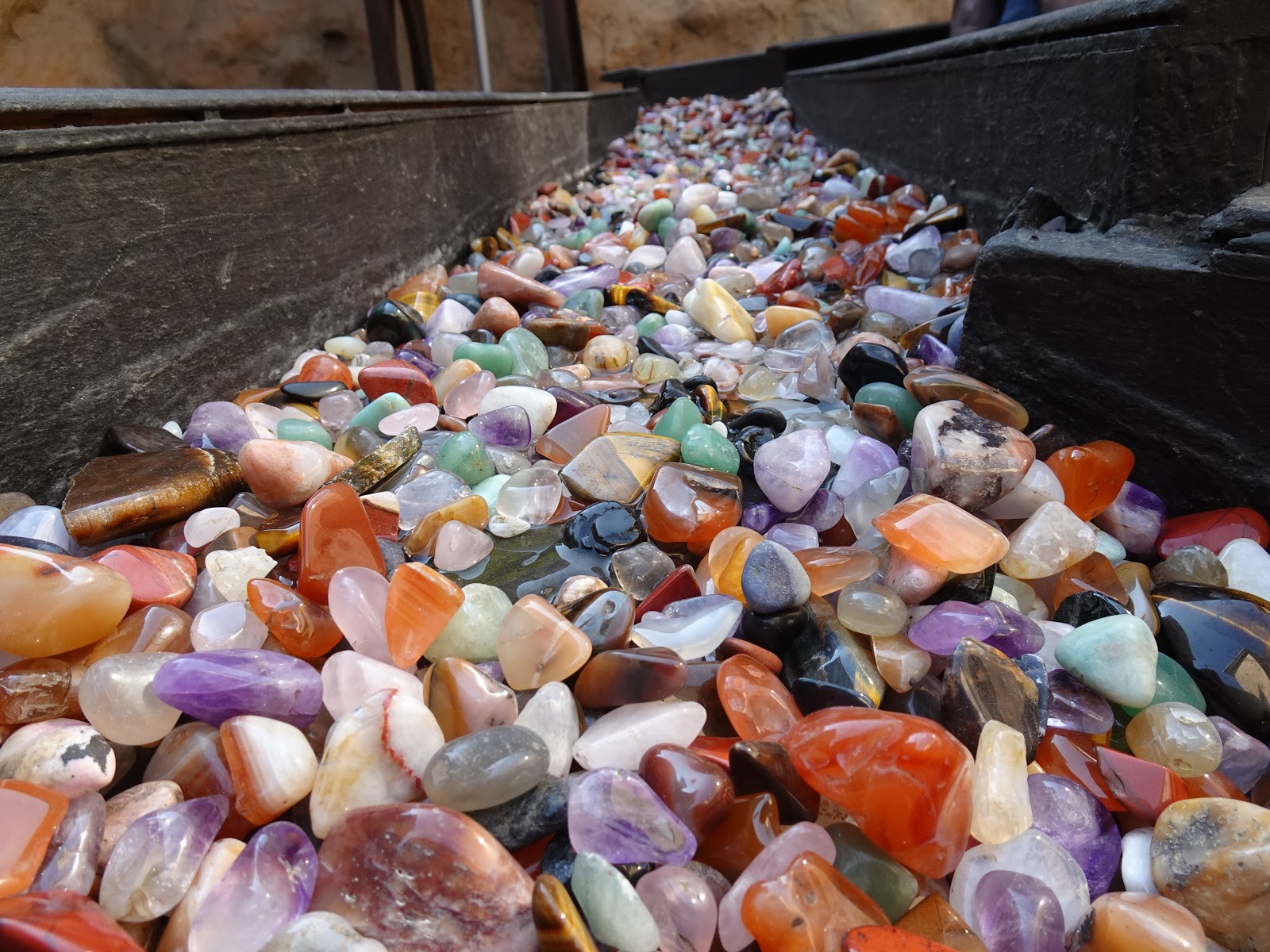
Kristall Galerie

Kristall Galerie, Swakopmund, Namibia 2019

Kristall Galerie, Swakopmund, Namibia 2019

Kristall Galerie, Swakopmund, Namibia 2019  

First morning, we visited the Kristall Galerie, which is housed in a modern building. The Galerie claims to have the largest crystal in the world. There are lots of  semi-precious stones, a replica of the original Otjua tourmaline mine, and a craft area. There’s a shop, of course, with semi-precious stones available in many guises. It’s well worth a visit by anyone fascinated by geology and Namibia.

largest crystal in the world on display?
Kristall Galerie, Swakopmund, Namibia 2019

Walwis Bay, dune 7

Walvis Bay (meaning ‘whale bay’) seems larger and more spaced out than Swakopmund, though also quieter and slightly lacking in character. Most of the town’s activities centre around the lagoon. There are many activities (link). We took a kayak trips in the lagoon at Pelican Point and visited "dune 7". You can also do boat trips from the yacht club.  You can read about the kayak trip in anoter blog (link)


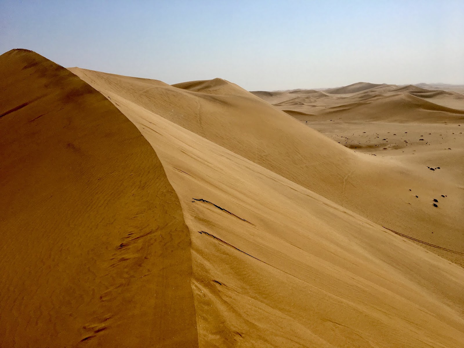
Dune 7 was a nice stop, but there are many more interesting dunes in Namibia, especially in Sandwich Harbour

Dune 7, outside Walwis Bay, Namibia 2019

Saturday, 3 August 2019

Driving along Skeleton Coast


Skeleton coast got its name from the ships and unlucky sailors who perished after being shipwrecked on the barren shores


The fishing trawler, that was sold as scrap metal to an Indian company,
got stranded after it came loose from its towing line
shortly after it left Walvis Bay

Zeila stranded 25 August 2008 early morning 14km south of Henties Bay
It´s easy to visit, our daughter inspecting the wreck from safe distance

Even if the sailors survived the shipwreck, their problems had only just begun

Treacherous fogs and strong currents forced many ships onto the hidden and ever changing sandbanks underwater at Skeleton Coast. Even if the sailors survived, their problems had only just begun. The coast is a barren line between the cold pounding ocean and the desert interior.

Planned route from Swakopmund to Terrace Bay
along Skeleton Coast, 360 kms (route details)

We are heading for Terrace Bay, the furthest north visitors can drive on the coast
The road we follow, C34, runs all the way from Swakop to our destination at Terrace Bay. It´s nearly parallel to the ocean and seems continuing forever with sea on one side and clay or sand on the other. After approx. 250 kms, the endless gravel and rock surroundings are released by the northern dune sea.

Reaching the nothern dune sea, on C34 near Uniab dry riverbed 

Driving along the coast, we pass the main rivers starting far indland in the mountains. Most of the year, they are just dry sand rivers only occasionally flowing overland for a few hundred meters before they vanish from the surface into the sand again. From south, we pass the riverbeds of; Omaruru, Ugab, Huab, Koichab, and Uniab, before reaching Terrace Bay. In the river beds you can encounter gemsbok, kudu, springbok, steenbok, jackals, genets, and small wild cats. At rare occations hyena, giraffe, zebra, lion, and cheetah.

We saw many jackals, this one just after Ugab River Gate
entering Skeleton Coast Park

Skeleton Coast Park, Namibia 2019

Skeleton Coast Park gate,  the skeleton warns you that is very far to help.!
Be prepared before driving in. and always stick to the track
Avoiding loose sand (se next postings!)

In 2012, we drove west from Purros towards the Skeleton Coast along the dry Hoarusib riverbed, where we encountered a wild elephant trying to attach the car (link). It´s indeed fantastic to se the wildlife on first hand - and quite surreal - in this deserted area, but it´s OK without desert adapted elephants chasing our car this time.

Terrace Bay

Terrace Bay, our final destination, is a desolate spot, slightly surreal. It´s like reaching a base on planet Mars (not that I have tried). Originally build as a mining venture, it´s lone palms and simple buildings loom out of the mist. Fishermen come here all year. There is a "petrol station", probably the most lonely in Namibia, and Terrace Bay Camp resort, with functional but very simple bungalows. the staff are friendly and the "restaurant" very fine given the extreme location. It whole place reminds me of some of the places I have seen in Greenland. 

The direct view from our very large beach chalet
Don´t go swimming (it´s very cold anyway)

Our very private villa!

Wednesday, 24 July 2019

Danish family on new Namibia adventure

Desolate coastline, desert adapted elephants, pristine rivers, and spectacular water falls driving 3500 kms through the pristine African wilderness the next four weeks!

If we get through Heathrow Airport industriel actions this weekend :-(


We, father, mother with adult daughter and son, are heading for Namibia in southern Africa once again, with a small diversions into Botswana (Okavango Delta) and last pit stop in Zambia (Vic Falls). Afrika has turned into our family´s favorite destination. E.g. by now, I have had the pleasure and privilege of visiting sixteen different African countries.

Our daughter 10 years old in Namibia 2009, near Aus

Why travel in Africa?

Why do we just love travelling in Africa? And why do we often include Namibia in the itinerary?

In brief, Namibia has huge areas of pristine wilderness with many national parks and conservancies including the world´s oldest dessert with plants and animals found nowhere else on earth. Also, it has little industry or pollution with the clearest stars you will ever see. Best of all, you can explore Namibia independently driving for hours through endless plains, huge mountain areas, canyons, dry riverbeds, and game parks.

Read further motivations for travelling in Africa in our previous blogs, use the links below. The previous postings are in Danish, but you can select English top right. This time, I will blog in English ("Danglish"). It´s not my native language, therefore, please bear with me.
  • 2012 family trip to; Namib Desert, Kaokoland, Etosha, Okavango, Central Kalahari, Makgadikgadi, Moremi, Chope, and Vic Falls (link motivation)


Plans for this trip

We look forward to cover the estimated 3500 kilometers self-driving in a 4WD car from Windhoek in Namibia to Livingstone in Zambia, passing by Swakopmund, Skeleton Coast, Damaraland, Kaokoland, Kunene River, Etosha national Park, Caprivi Strip, and the Ogavango Delta.

First 1400 kms of the trip through north-western Namibia

From Windhoek to Swakopmund and north along Skeleton Coast

Our journey starts in Namibias capital, Windhoek. We head west out of the capital towards Swakopmund, the second largest town in Namibia. "Swakop" is an old German´ish town which spreads from the mouth of the Swakop River into the surrounding desert. It´s often described as Namibia’s main seaside "resort", but it isn’t really commercial by any western standards.

After three nights and lots of activities in Swakop, we drive north along the coast all the way to Terrace Bay, which is the last place you can reach by car (without special permission). Terrace Bay (and Restcamp) is described as a basic, but truly unique, amazingly isolated, desolate spot. From Swakop to Terrace Bay, we follow the shore of the South Atlantic Ocean along the remote and famous Skeleton Coast, towards Kunene Region / Kaokoland. First, we pass through the section of coast known as the National West Coast Tourist Recreation Area. The coast is described as desolate and barren but with evidence of life such as lichen fields, vegetated dune hummocks, insects, snakes, and jackals. Passing Cape Cross, we expect to encounter an enormous breeding colony of Cape fur seals.

Trip 2009, Namibian coast just south of Lüderitz 

Trip 2009, our children playing in the dunes
near Sandwich Harbour


Driving into Damaraland

After a night in Terrace Bay restcamp, we head back for Torra Bay before heading inland into Damaraland, which is an semi-desert wilderness region famous for desert-adapted elephants and black rhinos, among others. Our destination is Palmwag Lodge, which is attractively located next to a palm-lined spring in the Uniab River. The river often flows with water drawing elephants close to the lodge.

Damaraland 2012, near Madisa Campsite

Three days trekking expedition into Etendeka Mountains 

After sleeping one night at the campsite at Palmwag Lodge, we trek into one of Namibia’s most remote and untouched wilderness areas Etendeka Mountains which is twice the size of Denmark. We are followed by an expert guide from Etendeka Mountain Camp. Our first stop is River Camp, which should be a relatively easy two - three hours walk. Overlooking a waterhole, River Camp is described as a simple bush camp with bucket showers and meals cooked over an open fire. We will be sleeping out on platforms under the vast Namibian night sky. After a night of stargazing and rest (if not to many animal sounds!), we will experience the longest day of the trekking expedition - with a walking distance of 15 to 20 kms. This long walk should be rewarded with stunning views from Mountain Camp, which is located on the top (rim) of Crystal Mountain overlooking an abundance of crystals and rare rock formations. In 2009, we had the rare pleasure of visiting Crystal Mountain with our two children and a guide from Etendeka Mountain Camp. That was an extraordinary experience. We really look forward to see this place again! Last time, we arrived in a Land Rover with some steep driving before reaching the rim. This time, we will have to work harder walking all the way from Palmwag to reach the place.

Trip 2009, on the rim of Crystal Mountain, look forward
to sleep under the vast Namibian night sky

Trip 2009, crystals and rare rock formations

Opuwo, the administrative centre to Kaokoland

After our hopefully good trekking experience, we drive north along C43 towards Opuwo, which is the administrative centre to Kaokoland. The name Opuwo was (according to Wiki) given by the commissioner of Ondangwa, who came in search of land to build an office. Upon his arrival, he asked local headmen to give him land where he could build an office. The headmen gave him a small plot, and when the headmen tried to give him more land, Mr. Hahn responded saying "Opuwo (it’s enough for me). I don’t want any more land". That should be how Opuwo got its name. Opuwo is also known for it´s Himba population. This group of people is considered the last (semi) nomadic people of Namibia. In 2012, we met the Himbas in near Etaambura Camp near Orupempe, Kaokoland (link)

Trip to Kaokoland 2012; coffee beak in
dry river bed driving towards Opuwo

Reaching Kunene and Epupa Falls

We will only stay one night in Opuwo Country Lodge, probably sleeping well after the long trekking expedition the previous days, before we head towards Kunene River at Epupa Falls. Kunene River is about 1,050 kilometres long and flows south from the highlands in Angola to the border with Namibia, then west along the border until it reaches the South Atlantic Ocean.

At Epupa Falls, we stay at Epupa Camp overlooking the Kunene River about 700 metres upstream from Epupa Falls. There should be a wide choice of activities in Epupa Camp, e.g. self-guided walking trails along the river, bird watching excursions, visit to nearby Himba village, and rafting excursions. By the Epupa Falls, the Cunene River is 0.5 km wide and drops in a series of waterfalls spread over 1.5 km, with the greatest single drop being 37 m. The name "Epupa" is a Herero word for "foam", in reference to the foam created by the falling water.

After two days at Epupa Falls, we plan to head along D3700, which follows the bank of Kunene River from Epupa towards Ruacana, to get to Kunene River Lodge about half way to Ruacana. Along the route, we pass the Zebra Mountains. The 4x4 track is very famous and challenging, but we have heard it was upgraded recently thus perhaps not that challenging anymore - we will see. Under all circumstances, we expect to use a long day driving the 96 kilometers along Kunene River at slow speed. We hope to find another car heading in the same direction. Here is a nice description (scroll down) from another group driving the same way (link).

Around Etosha National Park

Etosha means "Place of Mirages", "Land of Dry Water" or the "Great White Place". It´s an apparently endless pan of silvery-white sand, upon which dust-devils play and mirages blur the horizon. It´s also one of Africa's best game reserves. Especially, during the dry season, when huge herds of animals can be seen. We have had the pleasure of visiting Etosha twice before in 2009 and 2012 (link). One of the more exciting moments was when  our tyre exploded near a group of elephants! (link) and when we had lions outside the tent at night (link). We hope for no tyre explosions this time...

Etosha 2012, repairing an exploding tyre near elephants!

Etosha 2012, son watching for elephants in the meantime

Caprivi Strip, tropical surroundings


Last 2400 kms from Etosha to Victoria Falls 

After leaving Etosha, we drive north-east towards a peculiarly shaped stretch of land called the Caprivi Strip. It defies any logical border definitions being sandwiched between Angola and Botswana and stretching towards borders of Zambia and Zimbabwe. It should be very different from the rest of Namibia as a tropical strip both fringed and crossed by wide rivers, including the Zambezi, Kavango (Okavango), Chobe and Linyanti. The national parks should have a good population of some of Africa’s iconic species as well as several species largely absent from the rest of the country, such as Cape buffalo, sable and roan antelope. Added to this is the opportunity to get out on a boat, an enjoyable and often welcome contrast to sitting in a 4WD. Read more about Caprivi at Expert Africa´s homepage (link)

Okavango Delta, lush water-wilderness

From Capvi Strip, we take a deviation into Botswana through Mohembo Border Control and through Shakawe village to revisit the Okavango Delta. The Okavango River rises in the highlands of Angola and flows southeast into the Kalahari, where it spreads out into a delta formation. It covers over 15,000 km² with a lush water-wilderness of papyrus swamps, shallow reed-beds and floodplains, dotted with islands and laced with a network of channels. In 2012, we had the most extraordinary boat trip with Kubu Queen house boat - one of our absolute highlights in Africa (link). This time, we head for Nxamaseri Island Lodge which stands on an island in the Okavango Panhandle, north of the Delta, about 37km south of Shakawe village.

Okavango 2012, gone fishing for tiger fish (link)

Okavango 2012

Okavango 2012

Heading towards Livingstone and "the Smoke that Thunders"

Finally, we Victoria Falls "the Smoke that Thunders". Victoria Falls were brought to the attention of the world in 1855 by Dr David Livingstone, who later famously commented:
"'scenes so lovely must have been gazed upon by angels in their flight". 
The Falls are 1,688 m wide and average just over 100 m in height. Up to 750 million liters of water cascade over the lip every minute, making this one of the world’s greatest waterfalls. Closer inspection shows that this immense curtain of water is interrupted by small islands that sit right on the lip of the Falls, effectively splitting them into smaller waterfalls. In 2012, we had the pleasure of swimming in "Devils Pool" on one of those small islands (link). This must be the worlds most extreme place to swim! The family is voting against me about trying the pool again this year and threatening mutiny if I insist.

Victoria Falls 2012, daugther inspecting the falls from above (link)

Self-driving in Namibia, why?

Why do we like self-driving in Namibia and surrounding countries? I found this Vimeo video (link) that gives you a good impression of the experience self-driving in the dry parts of  Namibia. However, we expect a different feeling driving along Kunene River and the Caprivi Strip, as this part of the country is very different from the rest of the country with images of lush green floodplains, herds of wildlife and ancient baobabs. Also, in Caprivi strip, we imagine to see many villages, goats, donkeys, and cows grazing by the roadside, and stalls sell everything from wooden carvings to fresh fruit. 

You can also read more about self driving at the Expert Africa homepage (link) And more about the road types (link). Also, we appreciate the Bradt Guide by Chris McIntyre very much having tried most guide books for Southern Africa over the years (link)